People keep learning the hard way that blindly following a navigation app's directions isn't a good idea. These painful lessons often end with drivers getting stuck in embarrassing or even dangerous situations and sometimes having no option but to wait for emergency teams to rescue them.
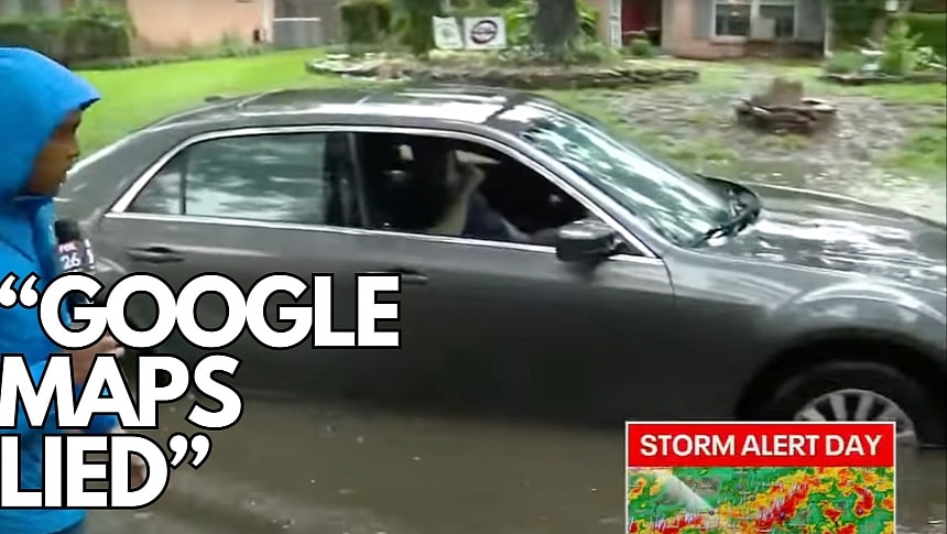
It happened recently in Kingwood, where a driver got stuck on a flooded road after following Google Maps.
The driver in this video followed the navigation app to get to his destination, and despite the road ahead looking impossible to use because of the heavy storm, he still wanted to use it. He tells the reporter that Google Maps lied, so he's now waiting in the car, with the water already reaching his feet, for a tow truck to get the vehicle out.
Ironically, other drivers can be seen in the video avoiding the flooded road, albeit the reporter says he did spot a bunch of other drivers trying to and eventually managing to get through the flood.
Fortunately, the man did not end up in a life-threatening situation, but it's an important lesson always to double-check what happens on the road no matter what the navigation app says. Google Maps can't always be up-to-date with road conditions, and despite suggesting a specific route, you don't have to follow it if it looks dangerous.
This case also highlights a big difference between Google Maps and Waze, the other Google-owned navigation app that many believe the search giant would eventually discontinue (and merge with Google Maps). Waze offers reports for flooded roads, assuming another user spotted the water and sent a report in the app.
Waze bundles a crowdsourcing traffic reporting system, allowing users to pin the location of a wide range of hazards on the map. Using these reports, Waze can generate warnings shown to other drivers running the app. The application also includes support for flooded roads, and while you might still be sent to a route with such a hazard, you'll get a warning before you reach the flagged location.
However, everything comes down to common sense. Waze warns about flooded roads, Google Maps doesn't, but your route could still get through a sector covered in water, so the driver must decide if they continue the journey or turn around and find a safer and dry alternative.
Considering the recent storms and the number of flooded roads, drivers should also check official sources for traffic information before getting behind the wheel. Applications like Waze and Google Maps could help direct a driver to their destination, but authorities and other users on the road (in applications where a crowdsourcing component exists) can offer more accurate information on which areas to avoid to stay safe.


